
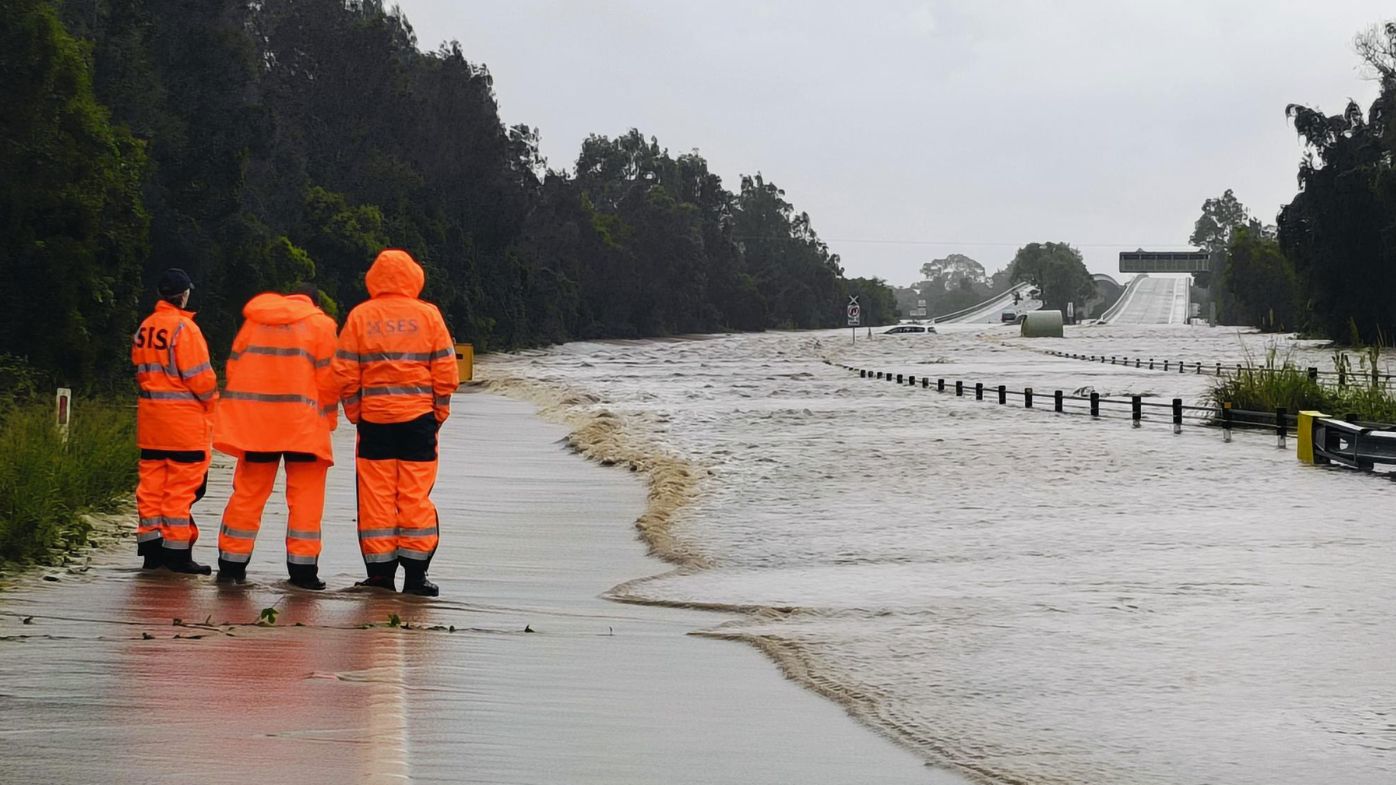
SES on standby for flooding over large parts of NSW as downpour persists
The SES is today urging residents in northern and north-western NSW to prepare for possible flooding as the downpour persists.
A flood watch has been issued for parts of the Mid North Coast, Hunter and North West Slopes, with minor to moderate flooding likely from late today and isolated major flooding possible.
Minor to moderate flooding is also possible in the Hunter and Colo River catchments from tomorrow morning.
READ MORE: Man killed in Sydney's second public shooting in days
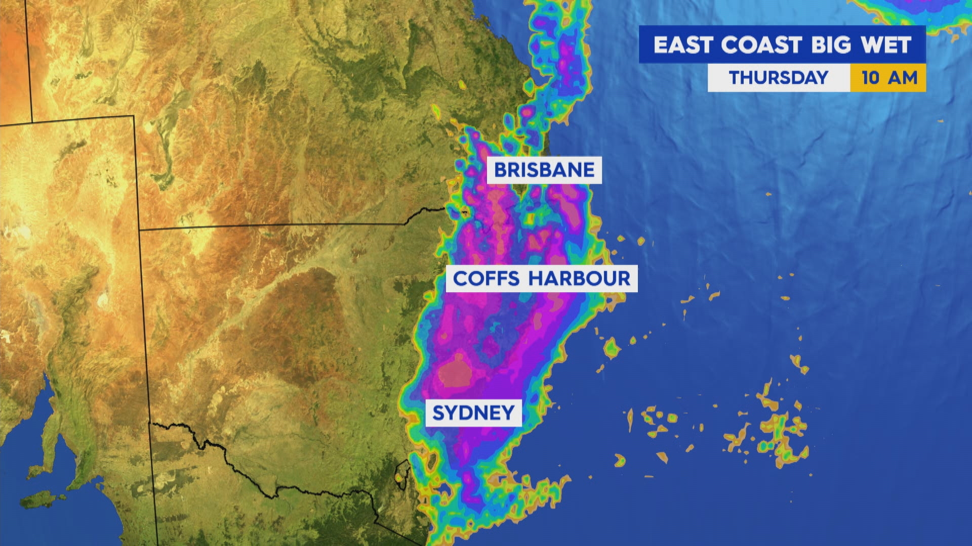
Rainfall is forecast to develop west of Tamworth in the state's north-east from today, with moderate 24-hour totals of 30mm to 45mm likely, and isolated falls of 70mm possible.
Along the northern and Central Coast and adjacent ranges, rainfall totals are expected to peak tomorrow, with 25mm to 80mm likely and isolated falls of 110mm possible.
NSW SES Assistant Commissioner Colin Malone said the organisation is preparing assets and personnel to respond.
"We're sending aviation assets, high clearance vehicles and crews into the areas likely to be impacted by this rainfall," he said.
"While we're prepared for an increased volume of calls for assistance, we ask the community to prepare too.
"Stay across the latest warnings and advice via the Hazards Near Me app and set up a watch zone for your local area."
READ MORE: Netanyahu launches extraordinary personal attack on Albanese

He urged residents in impacted areas to have a flood emergency plan in place before waters rise.
SES flood warnings remain in place for communities in western NSW as floodwaters caused by a coastal low-pressure system earlier this month continue to move downstream.
A total of 24 warnings have been issued for communities to stay informed about possible flooding.
Residents are being reminded to never drive through floodwaters.
The downpour across the east coast is forecast to intensify from today, with a warning of thunderstorms and high winds in many parts.
Sydney is heading for a maximum rainfall of 35mm today, with a maximum of 45mm forecast for tomorrow.
Wind strengths will also increase over the coming hours.
The bureau has issued a strong wind warning for the Macquarie and Hunter coasts from tomorrow.https://twitter.com/NSWSES/status/1957658635594502283?ref_src=twsrc%5Etfw
Meanwhile, the drenching over south-eastern Queensland is forecast to continue for the next two days.
A trough moving east across the southern interior of the state is pushing into south-eastern parts, bringing the chance of thunderstorms near the coast, Wide Bay and Burnett and over the southern interior.
Brisbane is forecast to receive a maximum rainfall of 35mm today and tomorrow.
The downpour is set to ease on Friday, with the system pulling back toward the coast.
People can stay up to date with the latest weather warnings at the BoM website.
DOWNLOAD THE 9NEWS APP: Stay across all the latest in breaking news, sport, politics and the weather via our news app and get notifications sent straight to your smartphone. Available on the Apple App Store and Google Play.