
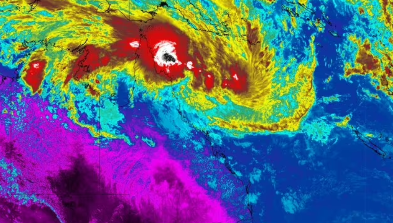
Tropical Cyclone Koji crosses Queensland coast
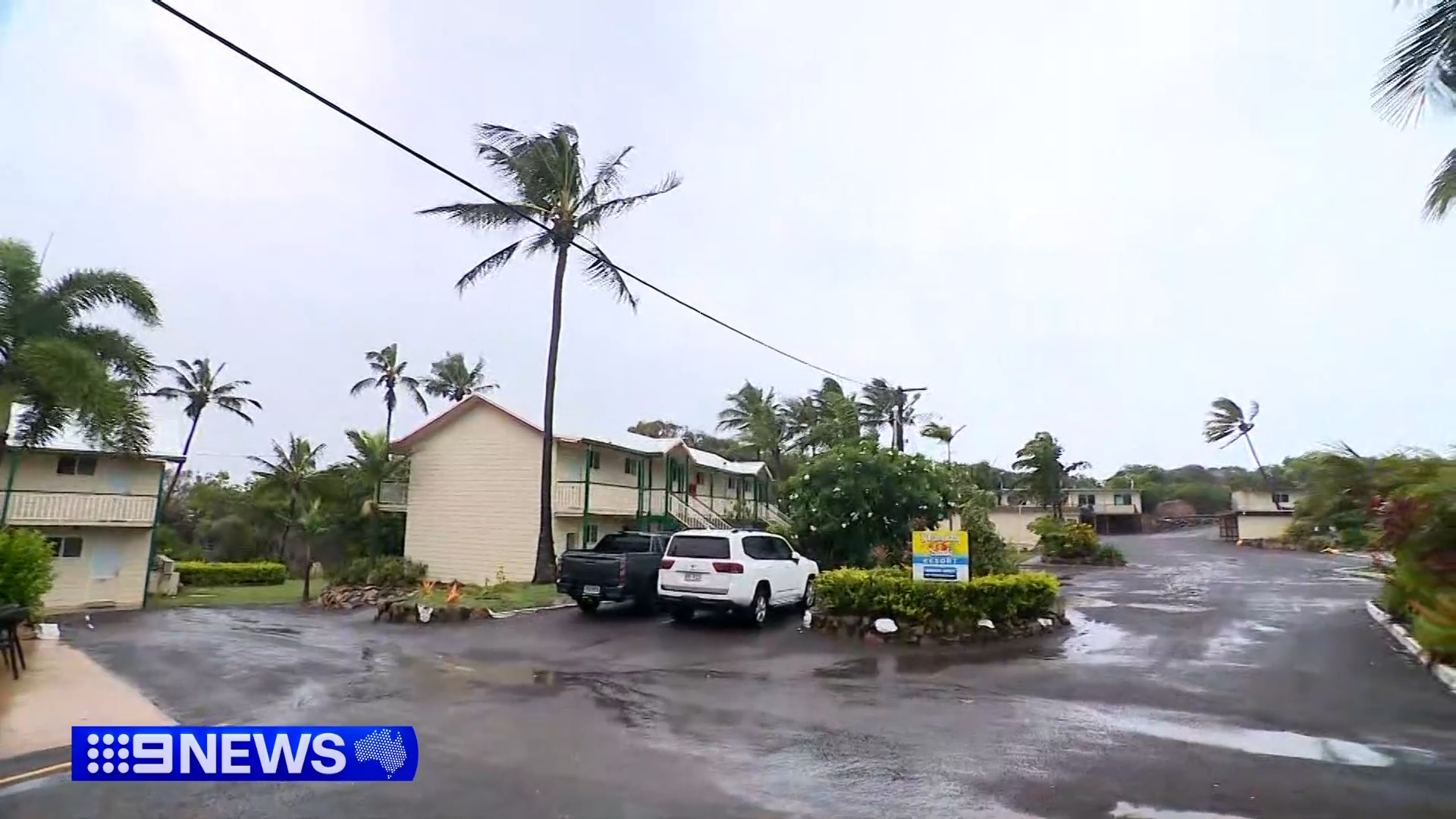
Tropical Cyclone Koji has officially made landfall in Queensland, bringing with it heavy rains and gale-force winds.
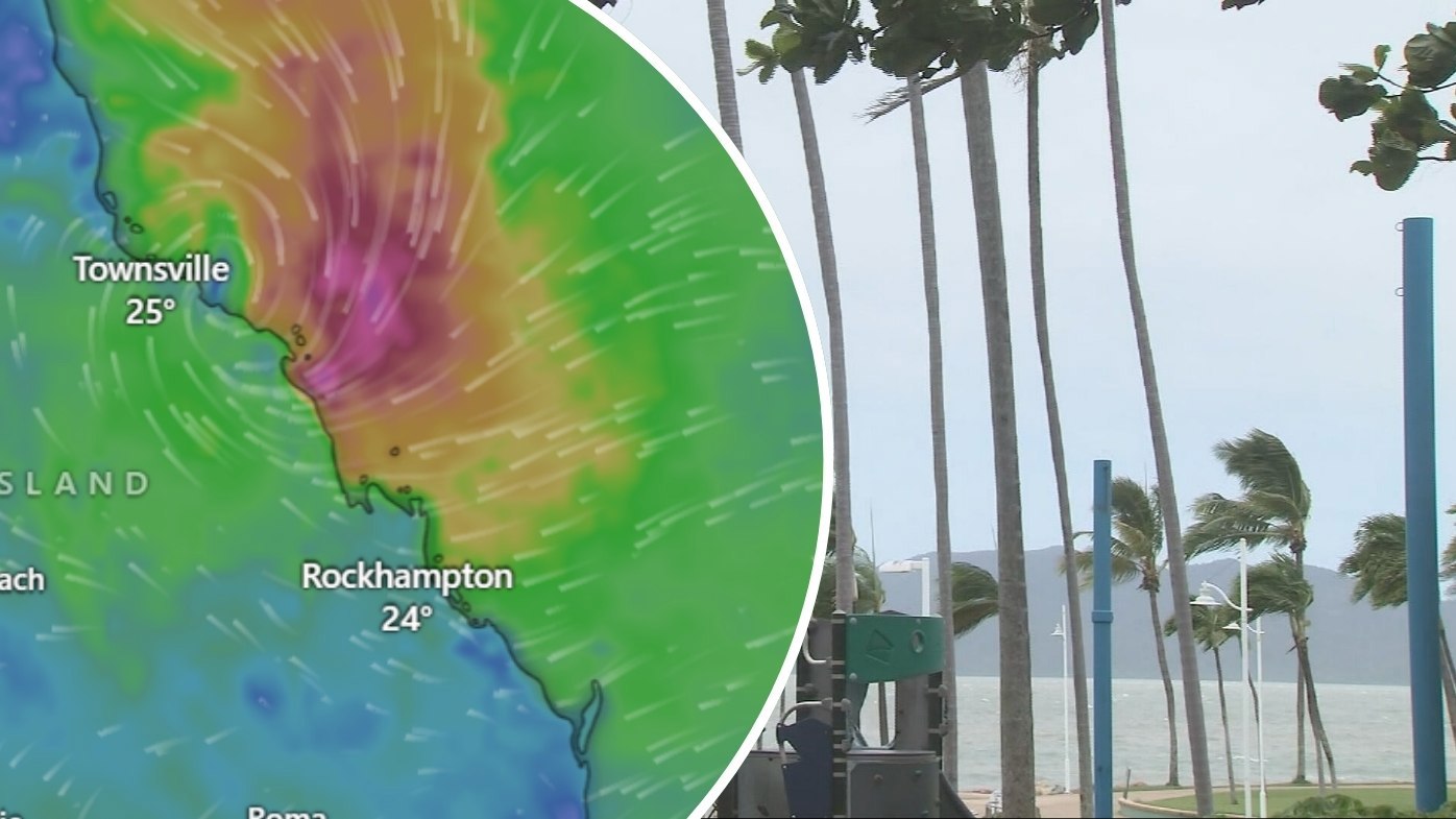
The tropical low was declared a cyclone overnight and is now a Category 1 storm.
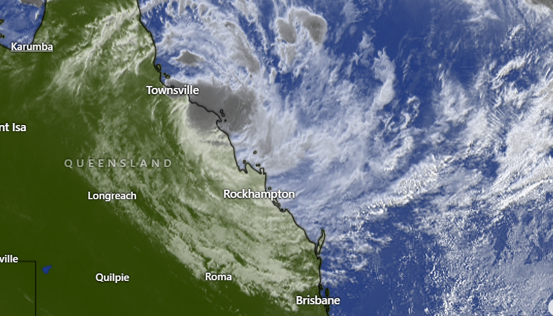
It has now crossed the coast near Ayr, north of Bowen, and is soaking large parts of the north coast all the way down to the Whitsundays.
LIVE UPDATES: Cyclone set to make landfall, bushfire battle rages on
READ MORE: FBI won't co-operate with state investigators in ICE shooting case
Cyclone Koji has been described as a "lopsided" system with the heaviest rainfall near its south.
The Bureau of Meteorology has warned residents in and around Ayr and Bowen will see the heaviest rainfall over the coming hours.
The slow-moving system picked up more strength while out at sea, as it tracked south towards the Queensland coast at a speed of 18km/h.
READ MORE: 'It was too late': Brigade commander loses home while defending neighbouring properties
The BoM's warning zone currently extends from Ayr to Mackay, including the Whitsunday Islands, Bowen and Proserpine.
The warning for Townsville was cancelled overnight.
There are multiple "take shelter now" emergency alerts in place.
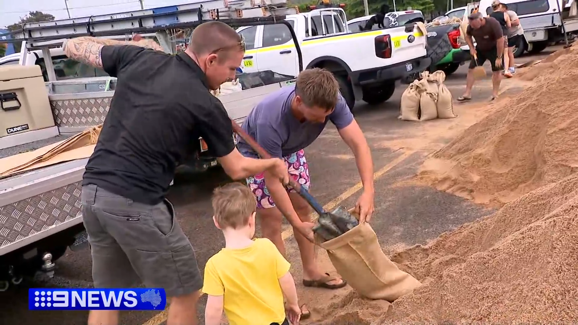
Locals are being told if they have any concerns, to get themselves to evacuation shelters and facilities to keep themselves and their families safe.
Koji's effects have already been felt along Queensland's coastline with choppy surf and palm trees resembling rag dolls, as they flop back and forth in the wind.
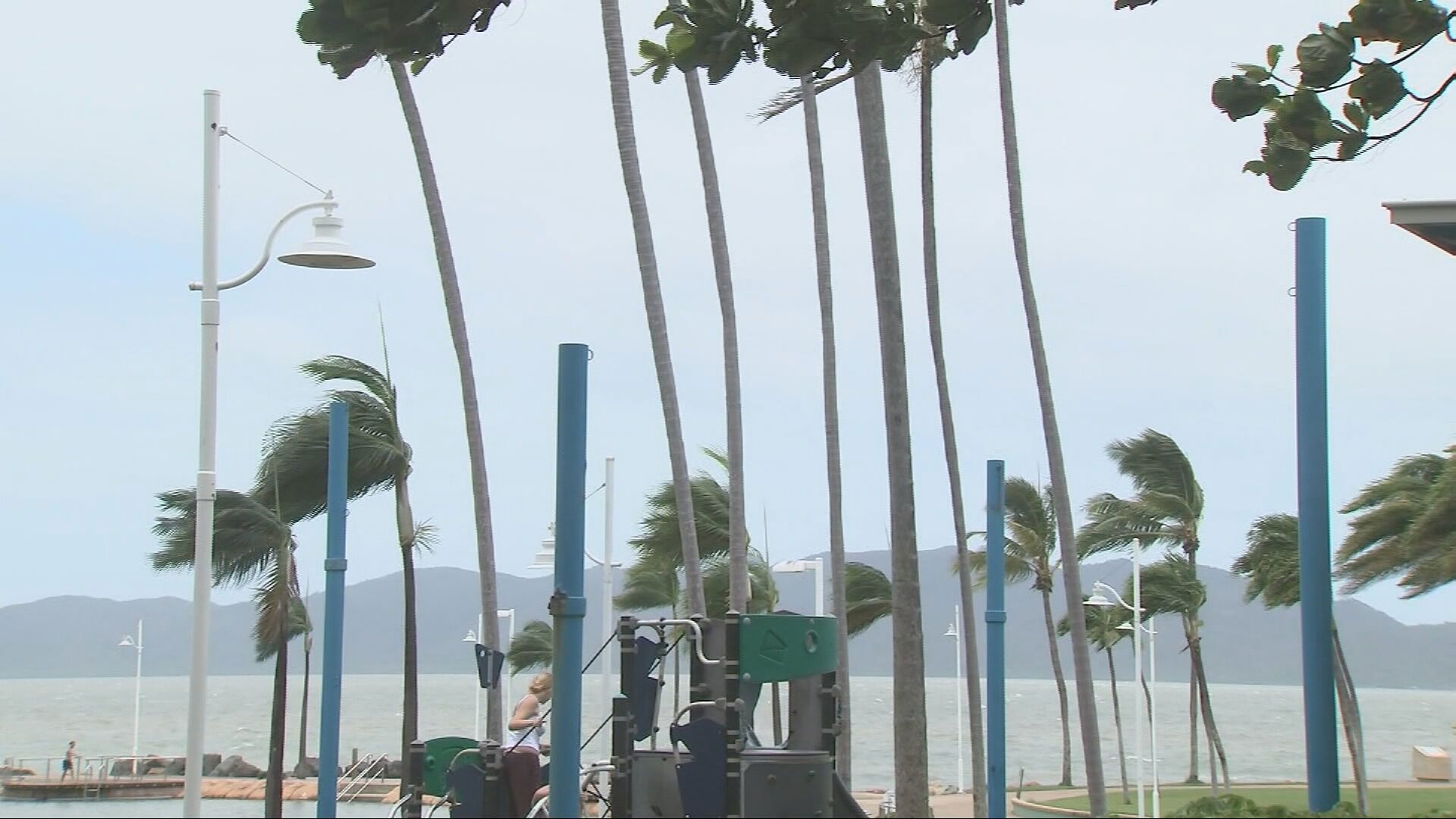
The bureau warns of gales with damaging wind gusts of up to 100km/h between Cardwell and Airlie Beach overnight, which may extend south to areas between Proserpine and Mackay during the morning.
The gale-force winds are expected to ease rapidly now Koji has crossed the coast.
Cyclone Koji will soak inland parts of Queensland as it tracks further inland and weakens back into a tropical low.
Townsville Airport has already closed until the system passes over and dozens of flights into and out of Hamilton Island have been cancelled.
A severe weather warning is currently in place for heavy to locally intense rainfall and damaging winds about the northeast and central Queensland coasts.
Heavy rainfall which could lead to flash flooding is forecast to develop from Ingham to Proserpine tonight.
Locally intense rainfall, which the BoM says "may lead to dangerous and life-threatening flash flooring", is possible between Townsville and Proserpine overnight, extending south to Mackay on Sunday.
Complicating management of the weather event is a serious connectivity issue affecting the Townsville area.
READ MORE: NSW set to face extreme fire dangers
A thief cut a telecommunications line while trying to steal copper in Deeragun.
"My message to that lowlife is you have put at risk the lives of North Queenslanders in their hour of need and you can't get a lower act than that," Premier David Crisafulli said.
"And we intend to make sure that we throw the book at this individual when they are caught.
"Telecommunications are life and death."
DOWNLOAD THE 9NEWS APP: Stay across all the latest in breaking news, sport, politics and the weather via our news app and get notifications sent straight to your smartphone. Available on the Apple App Store and Google Play.