
More heavy rain, giant waves to batter NSW coast across weekend
The downpour across coastal NSW is forecast to reach peak strength on the weekend, accompanied by damaging winds and heavy seas.
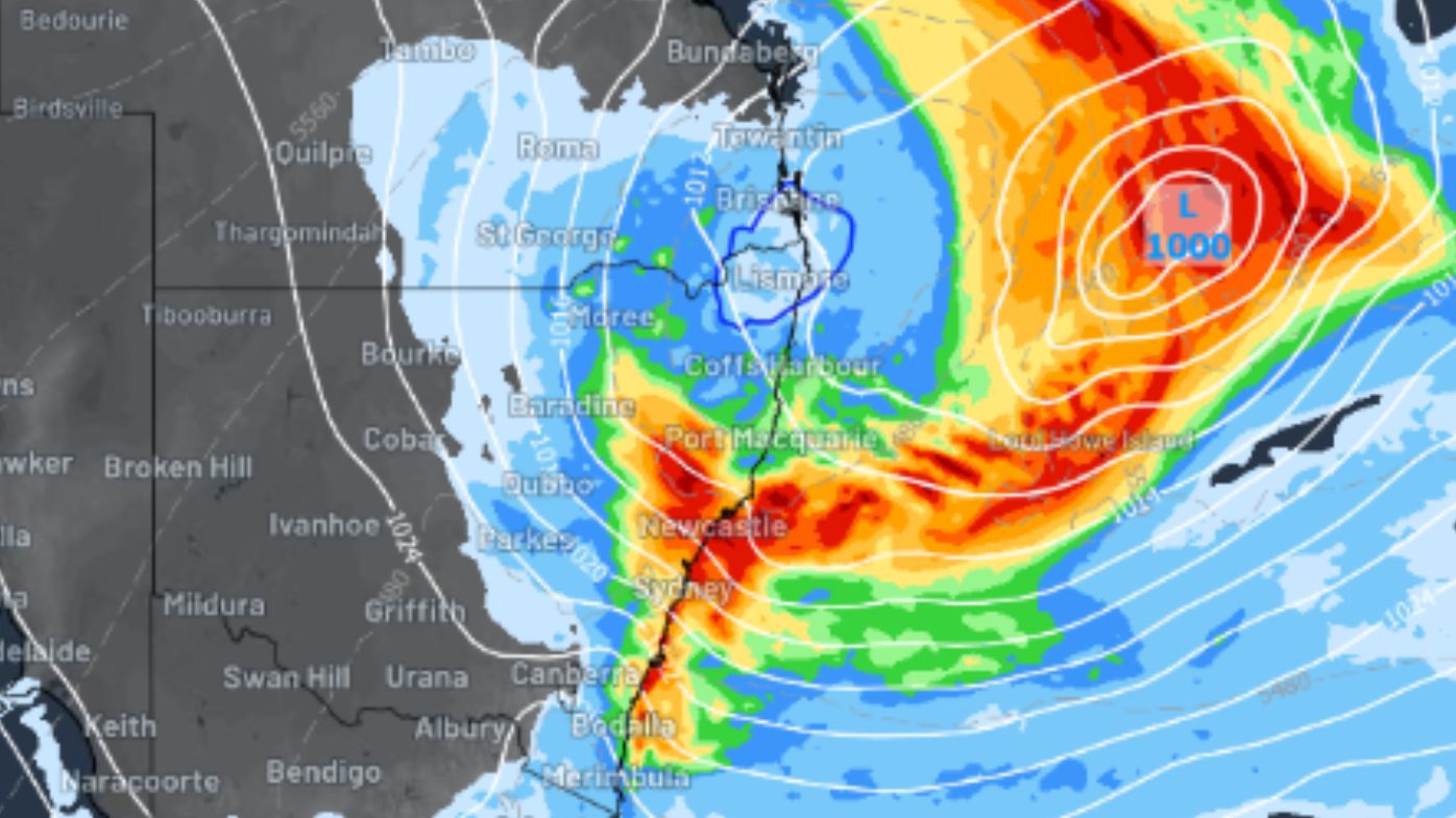
A low-pressure system expected to be sitting off the coast tomorrow is set to quickly gain strength by Saturday, reports Weatherzone.
The cold and soaking conditions are also being fuelled by cold upper-level air combined with moisture.
READ MORE: Millions of Sydney commuters ride free as gates turned off

Weather forecasters say further modelling is needed to pinpoint which areas of NSW will be hardest hit by the extreme conditions through the weekend.
But they are warning the Mid North Coast and the South Coast should expect falls of 100mm to 150mm over a period of 36 to 48 hours between Friday and Sunday.
Aside from the rainfall, coastal areas can expect to be battered by gales from the Tasman Sea, with waves as high as six metres in some parts.
The largest waves are most likely between Byron Bay and Seal Rocks, with significant wave heights reaching between 4.5 metres and 5.5 metres late on Sunday and into Monday.
But forecasters say, given maximum wave heights usually double the significant wave height, parts of NSW's coastline could record seas of 10 metres high at times.
READ MORE: Do you rely on the 'feels like' temperature or the actual one?
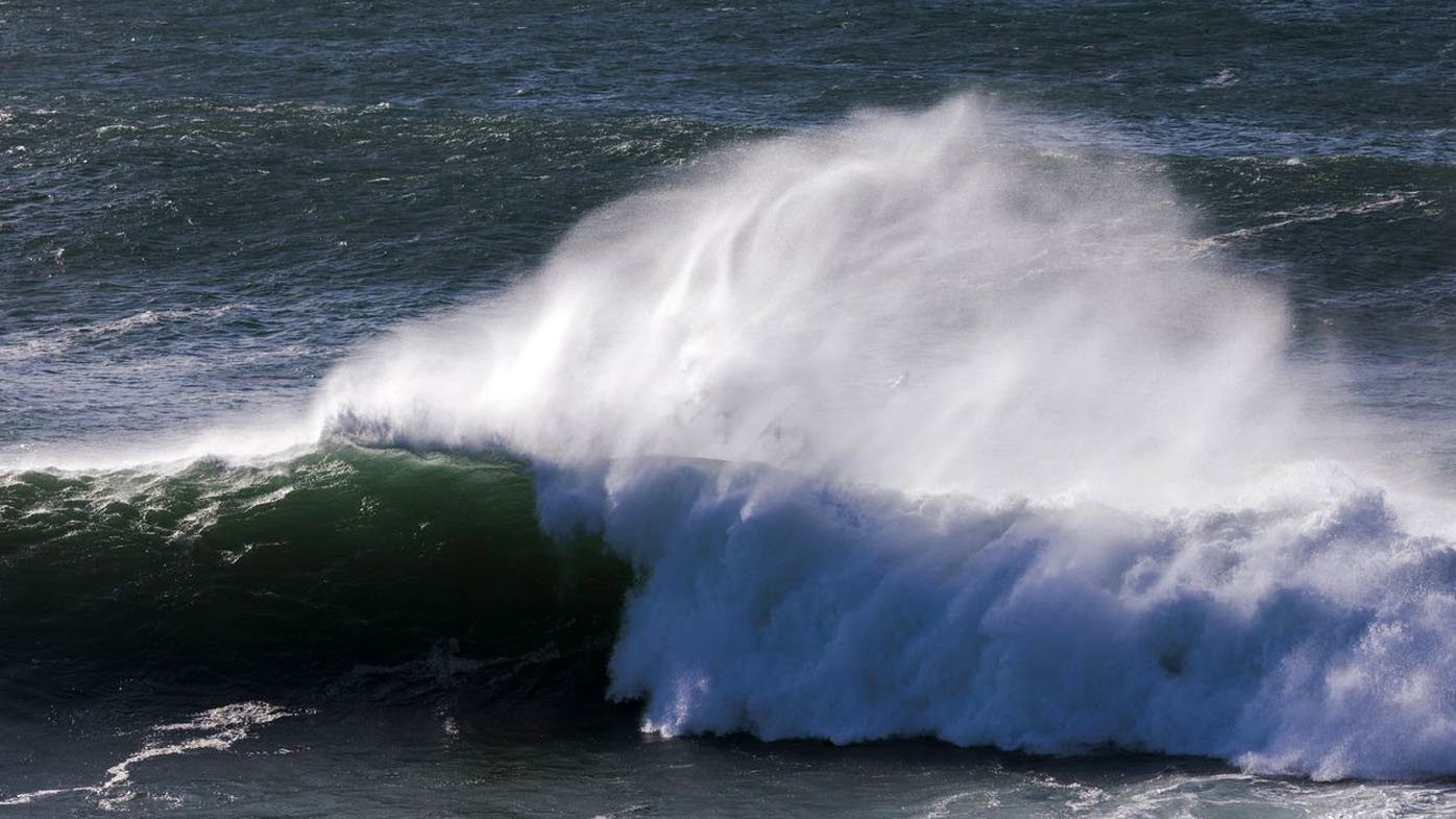
The powerful swells will also increase the risk of coastal erosion at hotspots, such as Sydney's Collaroy Beach, Byron Bay's Main Beach and the Central Coast's Wamberal Beach.
Surfers can look forward to cleaner and calmer conditions next week when the strong south-to-south-easterly winds ease.
DOWNLOAD THE 9NEWS APP: Stay across all the latest in breaking news, sport, politics and the weather via our news app and get notifications sent straight to your smartphone. Available on the Apple App Store and Google Play.