
'High' chance of cyclone as rain sweeps Queensland coast
North Queensland is bracing for a potential tropical cyclone as the Bureau of Meteorology warns of a "high" chance of development.
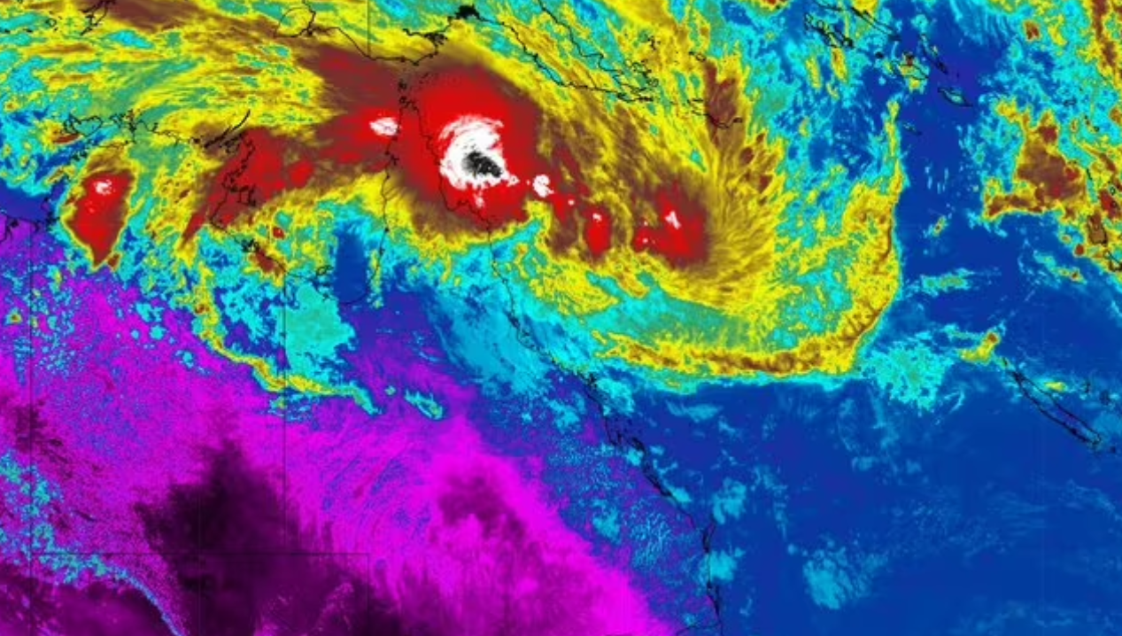
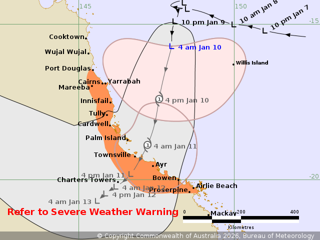
Tropical Low 12U is bearing down on the state and currently has a 60 per cent chance to turn into a cyclone.
The Bureau of Meteorology's Dean Narramore said while it was about a couple hundred kilometres north-east of Cairns, its effects were already felt.
LIVE UPDATES: Four emergency level fires across Victoria

"We've seen the rain already pick up well south of that around the Mackay-Central Coast area where we're seeing widespread rain develop there," he told Today.
"And that rain will continue to develop to the north as we move through today and tonight, as that low gets closer."
The Bureau is forecasting "widespread rainfall" by tonight heading into tomorrow, with falls of 100mm to 200mm, and isolated totals of as much as 400mm.
READ MORE: NSW set to face extreme fire dangers
Winds are also expected to pick up, with gusts of 80km/hr to 100km/hr into tomorrow.
"The rain is of most concern because we still have a lot of flood warnings current between Cairns and around the Townsville area, and this additional rainfall is going to lead to further and widespread river level rises," Narramore said.
The current warning zone covers Port Douglas to Airlie Beach, including Cairns, Innisfail, Townsville, Bowen, and Proserpine.
DOWNLOAD THE 9NEWS APP: Stay across all the latest in breaking news, sport, politics and the weather via our news app and get notifications sent straight to your smartphone. Available on the Apple App Store and Google Play.