
'Watch and prepare': Cyclone warning to be issued today for Queensland, northern NSW
Millions are being told to prepare as forecasters closely track the massive storm as it moves south.
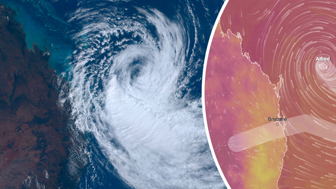
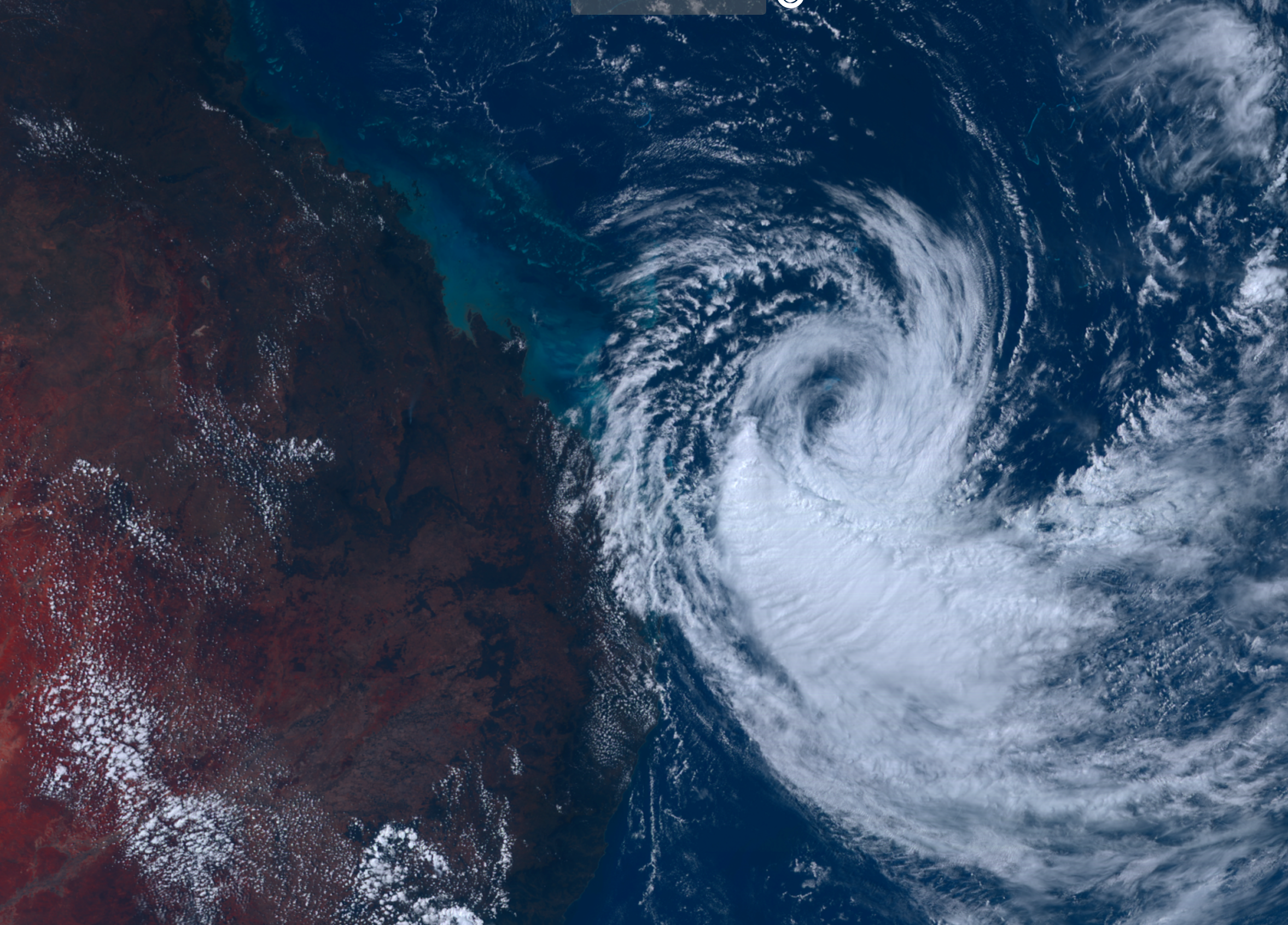
Tropical Cyclone Alfred has this morning strengthened again to a category two storm, just several hundred kilometres off the south-east Queensland coast.
The Bureau of Meteorology forecasts the storm to tack south-east again today, from its current position about 465km north-east of Brisbane, before turning back towards the coast on Tuesday or Wednesday.
The cyclone is expected to make landfall on Thursday or Friday, Steven Bernasconi from the Bureau said. If it makes landfall in a populated area of South East Queensland, it will be the first to do so in 50 years.
READ MORE: UK, France to work on ceasefire plan with Ukrainehttps://twitter.com/BOM_Qld/status/1896283198033633642?ref_src=twsrc%5Etfw
The Bureau expects Alfred to cross the coast directly in line with Brisbane, although its exact movements remain uncertain, and the warning area extends from Gympie to the Gold Coast.
"As it turns toward the west there will be greater confidence in its direction, and as it moves towards the coast we will know more about the actual location and potential crossing later this week," Bernasconi said.
Authorities are urging people in the south-east Queensland and north-east New South Wales region to use today to prepare for gale-force winds, significant rainfall and flooding, abnormally high tides and hazardous surf.
IN PICTURES: All the celebrity looks on the Oscars 2025 red carpet
Sandbagging stations are open at key locations across the south-east, and Queenslanders are encouraged to do all they can now to prepare their homes for heavy rainfall.
That includes cleaning gutters, securing loose items and ensuring they have food, water and batteries.
Residents in New South Wales are encouraged to download the Hazards Near Me app.
Currently, the storm has sustained winds at its centre of nearly 95km/h, with gusts of up to 130km/hr.
Marine wind warnings are in place from K'gari down to the north-east of New South Wales, with gale force winds lashing the coast.
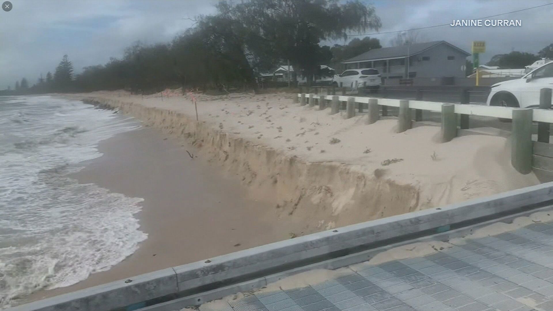
Heavy surf and high tides are already hammering at southern Queensland and northern New South Wales beaches, leading to ongoing erosion.
Flood-weary northern NSW braces for heavy rain
Widespread heavy rain fall is expected from late Wednesday, continuing into the weekend.
Northern NSW can expect between 100 and 300mm of rain on Thursday and Friday, Bernasconi said.
"Today is about watching and preparing," he said.
Cyclones are unusual in the north-east corner of New South Wales although the region is familiar with severe weather caused by east coast lows.
The most recent tropical cyclone to impact the area was Cyclone Nancy in 1990 and, prior to that, Cyclone Zoe in 1974, Bernasconi said.
"For New South Wales, in particular the north-east of New South Wales, experiencing severe weather through east coast lows which have sometimes similar impacts to tropical cyclones, the impacts are well known. "
Coastal river catchments from the Tweed and Rous rivers in the north of the state, to the Camden Haven near Port Macquarie are on flood watch for moderate to major flooding.
Catchments are already wet and the flood risk will be exacerbated by high tides, the Bureau warns.
READ MORE: 'Huge crash': Passenger describes moment cruise ship 'tilted'
Beaches hammered by high tides, hazardous swell
Dozens of beaches from Agnes Water in Gladstone down to Currumbin on the Gold Coast were closed over the weekend.
The largest waves were 16.9 metres off the Fraser Coast, with multiple waves above 10 metres, 9News Queensland weather presenter Garry Youngberry said.
Water was yesterday seen lapping at the Caloundra Power Boat Club on the Sunshine Coast.
On K'Gari, residents faced gale force winds and campers were warned to return to the mainland to avoid being caught by Alfred.
"It's blowing up really bad now," K'gari resident Kev Hockey said.
"We haven't really experienced these sort of conditions, certainly not in our adult life."
There are fears for Pumicestone Passage homes, particularly at Golden Beach, as the ocean pushes through a fragile protective sandbar on the northern tip of Bribie Island.
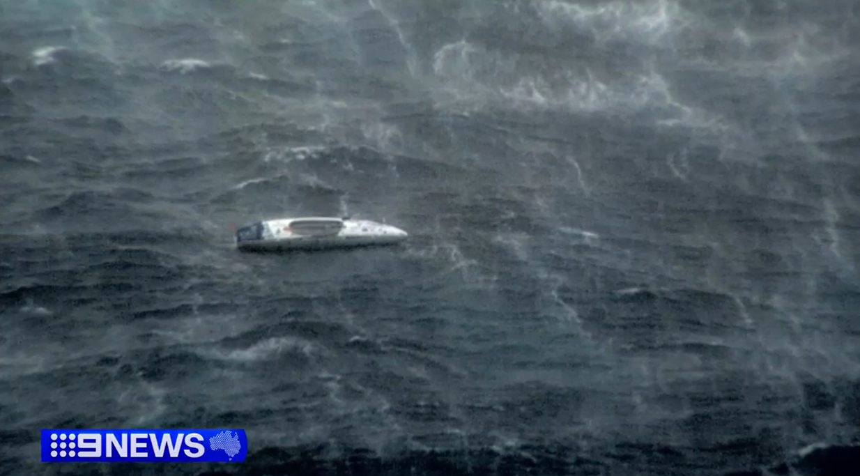
The Navy was working to reach a Lithuanian rower caught up in the system in the Coral Sea while on a solo journey from San Diego to Brisbane since August.
READ MORE: Pope Francis in stable condition but 'risk of crisis' remains
Queensland Premier David Crisafulli asked locals to prepare.
"I'm mindful that there is a big challenge there because of how severe the breakthrough has been in recent times and the prospect of those winds with big tides," he said.
"I know this is not a frequent occurrence and there may be Queenslanders who can be forgiven for thinking that this is something that doesn't occur well history shows that is does.
"We're just asking people to just be prepared and heed the warnings, do what you can to get ready, and you need to know that we've done the same."
DOWNLOAD THE 9NEWS APP: Stay across all the latest in breaking news, sport, politics and the weather via our news app and get notifications sent straight to your smartphone. Available on the Apple App Store and Google Play.